The best beaches in Corfu are not in one place, and that matters before you choose where to sleep. The island has two quite different coastlines, and a beach day on one is a different sport from a beach day on the other.
This guide goes coast by coast: how to reach each beach, when to go, and what you will or will not find at the bottom. It sits alongside my complete guide to Corfu, which covers everything else.
Many of the best coves sit at the foot of a steep green hill. Some have a road and a car park, some only a path. I have said which is which.
How the coasts differ
The west coast faces the open Ionian. This is where the sand is, the long beaches, the cliffs and the sunsets. It also gets the swell and the afternoon wind.
The north-east coast faces Albania across a narrow strait. It is sheltered, the water is calm and very clear, and the beaches are mostly pebbles in small bays under cypress and olive. It is the coast for snorkelling and for hiring a small boat.
The north coast around Sidari is soft sandstone, carved into channels. The south-west has the long dunes.
Crossing from one side to the other takes the best part of an hour, so pick a coast for the day rather than trying to do both.
Paleokastritsa and its coves
Paleokastritsa is a group of coves about 25 km from Corfu Town on the west coast, set between green headlands that drop straight into very blue water.
The beaches. Agios Spyridon is the sandy one, with bars, restaurants and shallow water for small children. Agia Triada is the handiest from the village, part sand and part pebble. Ampelaki, tucked between rocks, is quieter. Platakia is pebbly, with shade and sunbeds. La Grotta is all rock, down a run of steps, and is where people jump in.
The caves. The headlands are hollowed with sea caves, and you can be inside one within minutes of stepping off the sand. More in the Corfu boat tours guide.
The monastery. Entry to the Theotokos monastery on the headland above costs nothing; it closes for a few hours in the early afternoon, and you will need shoulders and knees covered. Go before the beach, while it is cool.
Getting there. An easy drive west from town, though parking fills in July and August. The green KTEL bus A9 runs from the intercity station for a few euros. Arrive early: the coves are small and the coaches come mid-morning.
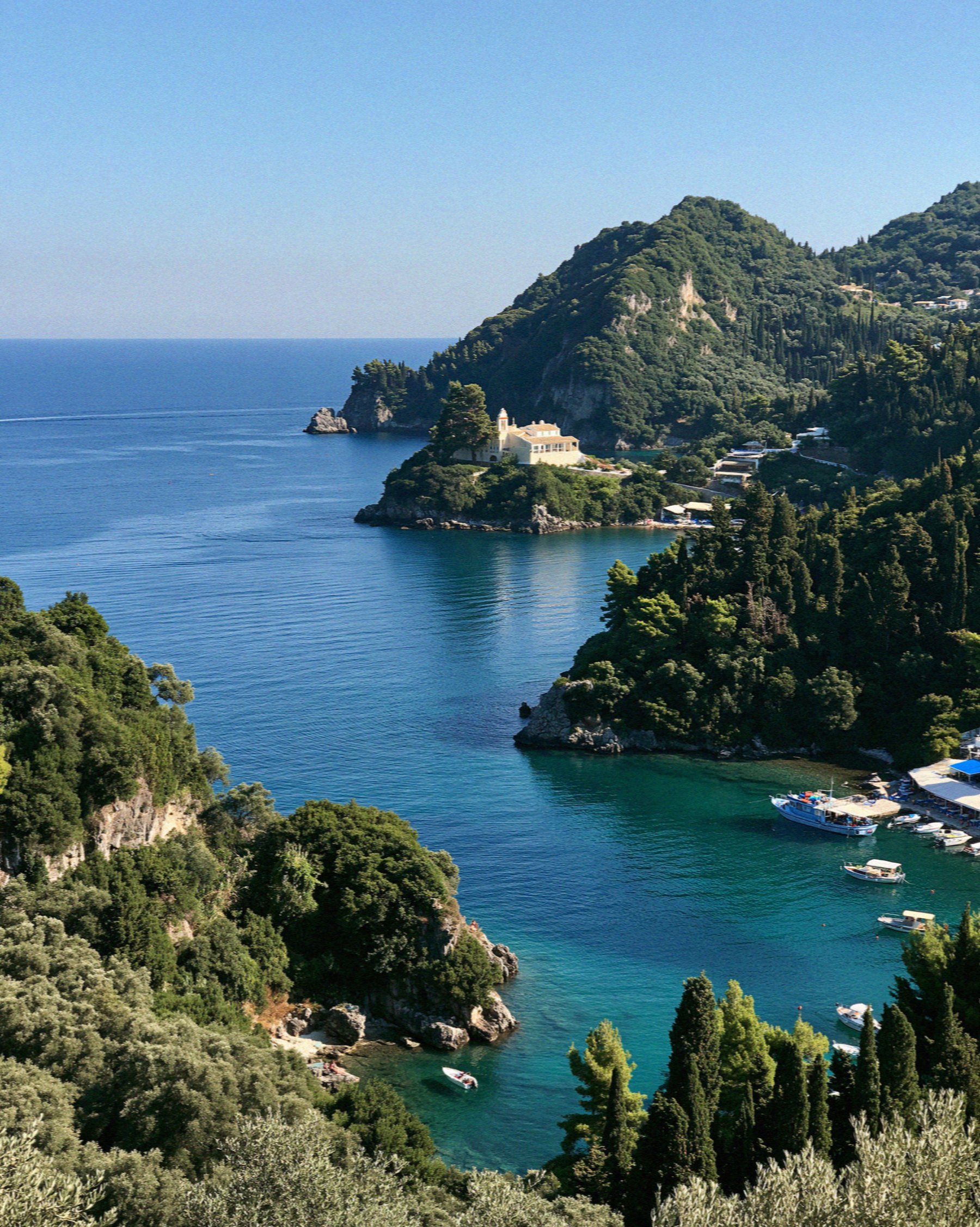
Porto Timoni
Porto Timoni is two small bays back to back, divided by a slim isthmus under Afionas, in the north-west. From above it looks like a drawing of a beach rather than a beach. You reach it on foot or by water, and there is nothing at the bottom.
The path. From Afionas it is about 1.1 km down a steep, rocky path, roughly 20 to 30 minutes down and about 25 back up, with around 140 metres of climb. Going down via the viewpoint and back makes a loop of about 3 km, an hour at least. Parts are loose and slippery. Wear trainers or walking sandals, not flip-flops, and carry water: the climb back is in full sun.
What is there. No taverna, no toilet, no sunbeds, almost no shade after mid-morning. Bring what you need and carry it back up.
Parking. Afionas has a paid car park, which opens at 09:00, and a little street parking that fills fast. Do not block anyone’s door.
By boat. Water taxis run from Agios Georgios beach to the south. Expect wet feet. Walking down and taking the boat back is a sensible compromise.
When to go. Be on the path as early as you can manage. By mid-morning both bays are full. The green bus A20 reaches Afionas, but not at an hour that suits this. It is a car beach.
Glyfada and Myrtiotissa
Glyfada is the long golden beach of the west coast, about 16 km from town, Blue Flag, with green slopes behind and clear water. It is fully organised, with sunbeds, beach bars and water sports. The road down is narrow and winding. The green B17 runs from town to the beach, while the B19 stops at the Glyfada junction above it. It is busy in high summer and it is the beach to be on at the end of the day, when the sun goes down straight into the sea in front of you.
Myrtiotissa is the other side of that coin. It lies between Ermones and Glyfada at the bottom of a long, steep, partly surfaced track. Park at the top and walk. In Prospero’s Cell, Lawrence Durrell called it perhaps the loveliest beach in the world. It is wilder than Glyfada, much of it naturist, with few or no facilities. Bring water for the walk back up.

Agios Gordios
Agios Gordios is a long, wide sandy beach about 20 km from town, half an hour or so by car through Sinarades. High cliffs stand behind it, and at the southern end a tall pinnacle of rock, Ortholithi, rises out of the sea.
It is a proper resort beach, with bars and tavernas on the sand, small hotels, kayaks and paddleboards. Parking is tight in high summer; the green bus B10 runs from town.
For the sunset, climb a little way up the hill behind the beach. The cliffs and the rock make sense from up there.
Rovinia
Rovinia is a small cove just south of Liapades, near Paleokastritsa, pebbles and soft sand, very clear water.
On foot. From Liapades, follow the signs to a small parking area, then about 600 metres of narrow path and steps. Take it slowly, and not with heavy bags at noon.
By boat. Sea taxis run from Gefyra beach in Paleokastritsa in a few minutes. This is how most people arrive.
What is there. No sunbeds, no toilets; now and then a small boat comes round selling drinks and ice cream. It is the beach I would pick for Paleokastritsa’s water without Paleokastritsa’s crowd.
Kalami, Agni and the north-east
The north-east is a run of small bays under Mount Pantokrator, with Albania so close across the strait that you can pick out villages on the far side. The beaches are pebble or shingle and the water is calm, clear and good for snorkelling straight off the shore.
Kalami, about 28 km from town, is a small curved bay with cypresses behind it. At the end of the beach stands the White House, the Durrells’ home from 1936 until 1939 and a taverna today (May to October). Small boats are for hire on the beach.
Agni is the next bay, smaller, known for its three tavernas at the water’s edge: Toula’s, Taverna Agni and Nikolas. It is as much a lunch as a beach, and people arrive by boat to eat.
Further along. Barbati, south of Nissaki, is a long shingle beach with easy access and deep, clear water. Kerasia, south of Kassiopi, is a small and quieter pebble cove. Avlaki, close to Kassiopi, is a wider pebbly bay.
Getting there. The green bus A4 runs up this coast towards Kassiopi, but the bays sit below the main road down steep lanes. A car or a hired boat makes it far easier. Bring water shoes.

Canal d’Amour at Sidari
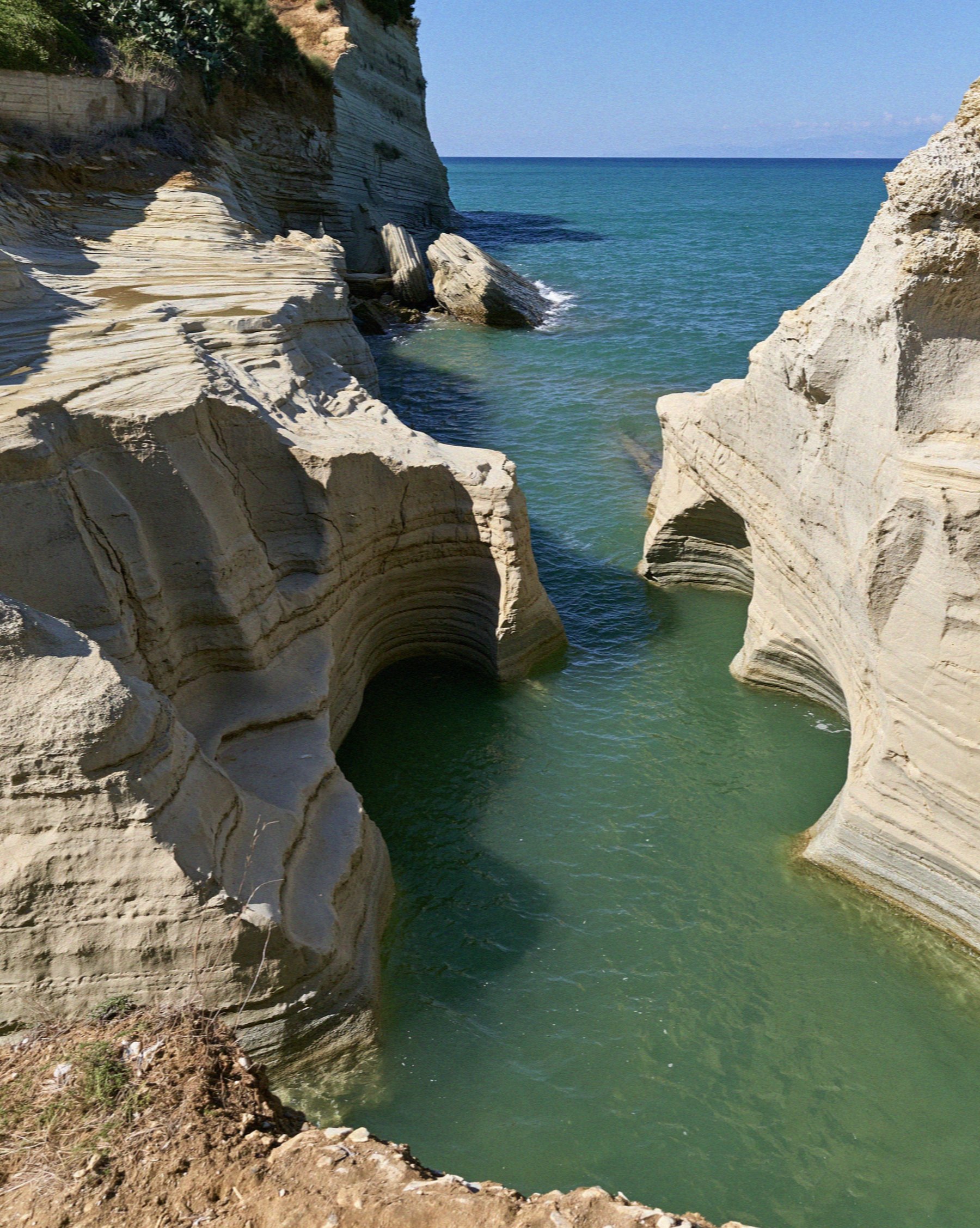
At Sidari on the north coast, about 35 km from town, the pale sandstone has been worn into channels, ledges and small arches with strips of sand at the bottom. The best known channel is the Canal d’Amour. The story goes that couples who swim through it together stay together.
It is beautiful and it is busy; Sidari is a big resort. Go early or late in the day, and watch your head on the rock if you swim through.
A few kilometres west, Longas beach at Peroulades sits below the cliffs, down a steep flight of steps. No sunbeds, a bar up on the cliff, far quieter than the canal. The green bus A2 runs to Sidari.
Issos and the south-west
Issos is about 3 km of sand on the south-west coast, roughly forty minutes by car from town, with wind-built dunes several metres high behind it. It lies within the protected Natura area of the Korission lagoon.
It is the least developed of the big sand beaches: a few umbrellas and sunbeds, no hotels. The water is shallow but the wind keeps it moving, which is why windsurfers and kitesurfers come. Stay off the dunes; they hold the whole place together. This is the beach for a long walk at the water’s edge.
Choosing a beach on Corfu comes down to choosing a coast, and that comes down to where you sleep. Where to stay in Corfu sets the bases side by side, the Corfu boat tours guide covers seeing the coves from the water, and my Corfu itinerary strings the best of them into a few days. For everything else, go back to the complete guide to Corfu.
Frequently Asked Questions
Which coast of Corfu has the best beaches?
The west coast, where Glyfada and Agios Gordios are, has the long stretches of sand and the sunsets, but more wind and swell. The north-east has calm, very clear water in small pebble bays such as Kalami and Agni, better for snorkelling and for children.
How hard is the walk to Porto Timoni?
About 1.1 km from Afionas down a steep, rocky, sometimes slippery path, around 20 to 30 minutes down and a little longer back. There are no facilities and little shade. Wear proper shoes, carry water and go early, or take a water taxi from Agios Georgios.
Are there sandy beaches in Corfu?
Yes. Glyfada, Agios Gordios, Issos and Agios Spyridon at Paleokastritsa are all sandy. The north-east coast is mostly pebble or shingle.
Can you reach Corfu’s beaches by bus?
The main resort beaches, yes: green KTEL buses run from Corfu Town to Paleokastritsa, Glyfada, Agios Gordios, Sidari and the north-east coast. They do not serve the wilder coves such as Porto Timoni, Rovinia or Myrtiotissa well, and a car makes those far easier.
Read also: The Best Corfu Boat Tours | Where to Stay in Corfu: Choosing Your Base | Victoria’s Complete Guide to Corfu